 Karteros Gorge is located east of Heraklion. It is part of a wider geological complex that consists of Astrakiano Gorge, Kounaviano Gorge and Karteros Gorge and all these are about 22 km long. It is integrated in the wider area of Ecological Park of Giouchtas, in Archanes. The park includes the Giouchtas Mountain and three gorges: the Knosanos, the Kounaviano and the Astrakano or the Karteros Gorge, which is also the longest. This area has been integrated into the NATURA 2000. All in all, the gorges are connected in various places with the settlements along their course. There are five main entrances: one from Karteros village, one from Aitania village (bridge of Aitania), one from Ag. Paraskies (Kolomodis area), one from Kato Astrakoi and one from the flatland of Peza (entrance of the Kounaviano Gorge).
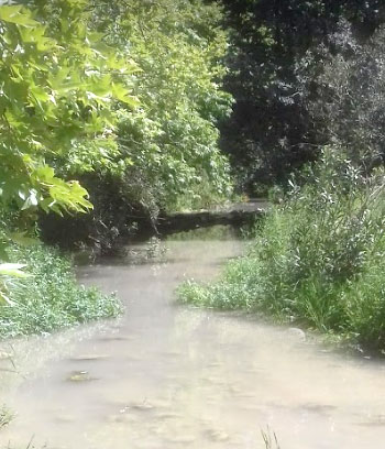
The scenery that one can see at the Gorge of Karteros is beautiful. It is a route that is distinguished by the richness of its natural, geomorphological and cultural features. It is a green path with springs and small lakes, while the wonderful formations in the rocks give the impression that the visitor is in a dreamlike place. The gorge is suitable for hiking or mountain bike rides. The duration of the whole trip is 3:30 hours and the route is not a problematic one, since it has become infrastructure projects making it ideal for families with children. It is a very well organized path with bridges, wooden railings along the course and it is marked to guide the visitors.
The Karteros Gorge is one of the largest in the region, with a total length of 12.5 km. It starts from the village of Kato Astrakoi, crosses the mainland and ends up in Karteros, a tourist area with a beautiful beach (Karteros Beach). In the green bed of the gorge and along the route, the Karteros River flows.
In the gorge, there are several old buildings, such as old chapels on the rocks, old watermills, small waterfalls and abundant vegetation which reveal that there was a high human presence in the gorge before. In the middle of the gorge, the landscape is interesting. At this part, the water increases, the plane trees are bigger and the river is wider. The Neraidospilios with the small artificial lake and the cave where the spring flows are also located there.
The rich waters of the area contributed to the creation of a watermill system along the gorge. With the aid of the water they took from the river, the farmers grinned up the grain of the region. 10 watermills had been operated before the war but none of them operate today while the remains of several of them are still in existence. The locals fished eels and crabs in the waters which, as it is mentioned, still exist. The ruins of a basilica dedicated to St. George are still on this road. It is a three-aisled Byzantine basilica. About 100 meters away, the church of Panagia, with a unique representation of a Byzantine bicephalic eagle above its portal is located. The road leads to the abandoned settlement of Kato Astrakoi (2km from Astrakoi) which was abandoned in the early 1930s. In the gorges of the park, sites of historical and cultural value have been found such as Eltyna, the Minoan settlement of Myrtia and the Minoan cemetery of Astrakoi.
At the exit of the Karteros Gorge in Mesa Karteros, where the information hut is located, a resting place built by the General Directorate of Forestry is found.
The flora of the gorge includes hydrophilic species such as plane trees, willows, kermes oaks and osiers as well as many endemic wildflowers and herbs. As for its fauna, it includes more than 44 bird species and 7 mammalian species.
It is certain that the visit at the Karteros Gorge will be an unforgettable experience for anyone who crosses it.